As TeamDev, working alongside Latitudo 40, it is contributing to a new model of urban planning that combines time and environmental comfort, funded by the Italian Space Agency
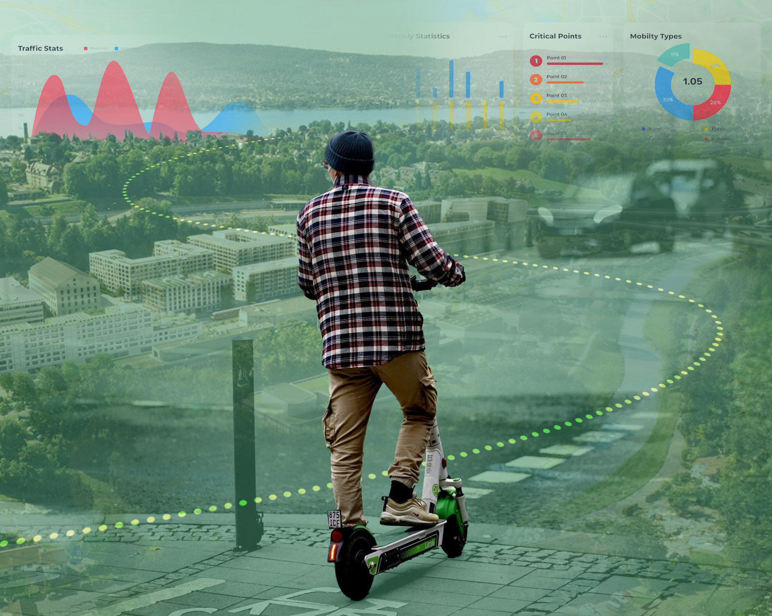
Cities today face a growing challenge: making urban mobility more efficient, but also more sustainable and safer for the health of those who use it every day. The shortest route is not always the best one if it passes through areas exposed to heat islands, pollution, or a lack of street greenery, a problem that particularly affects non-motorized transportation and micromobility.
This need gave rise to Green Navigator for New Soft Mobility, a project funded under the ASI call for proposals “Innovation for Downstream Preparation – Market,” promoted by the Italian Space Agency to support transportation management and sustainable mobility. The project is led by Latitudo 40, with TeamDev involved as a subcontractor, for an expected duration of 18 months.
The goal is to create a new urban route-planning tool capable of identifying optimized routes for sustainable mobility, accompanied by a model for classifying urban areas and support for planning public transportation stops.
The technology behind the project
At the heart of the project is the continuous analysis of satellite imagery, which generates reliable datasets—with a resolution of less than 10 meters—on three key dimensions of urban quality: heat islands, pollution, and street greenery.
This data feeds into a new environmental impedance function applied to the calculation of the lowest-cost route: an algorithm that not only minimizes travel time but also considers exposure to health risks along the way.
Building on this foundation, the project develops the “c-minute city” (comfort-minute city) paradigm as an innovative contribution: an extension of the “15-minute city” model that introduces, alongside the travel time to services, the variable of thermal and environmental comfort along the route.
The service will be made available through three channels: a mobile app for citizens and users, an API that can be integrated into existing navigation systems (sustainable mobility operators and MaaS platforms), and a dedicated dashboard for cities and operators.
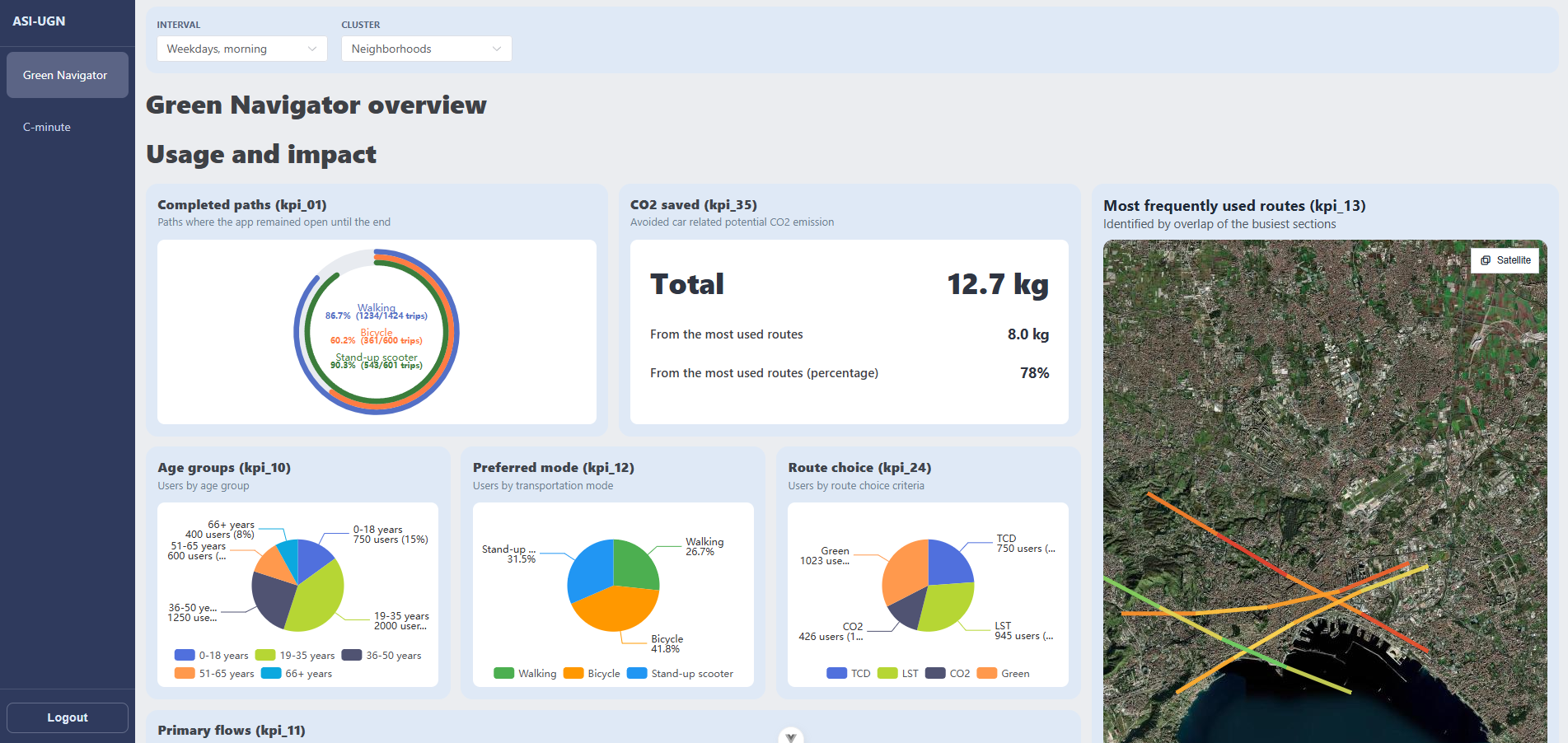
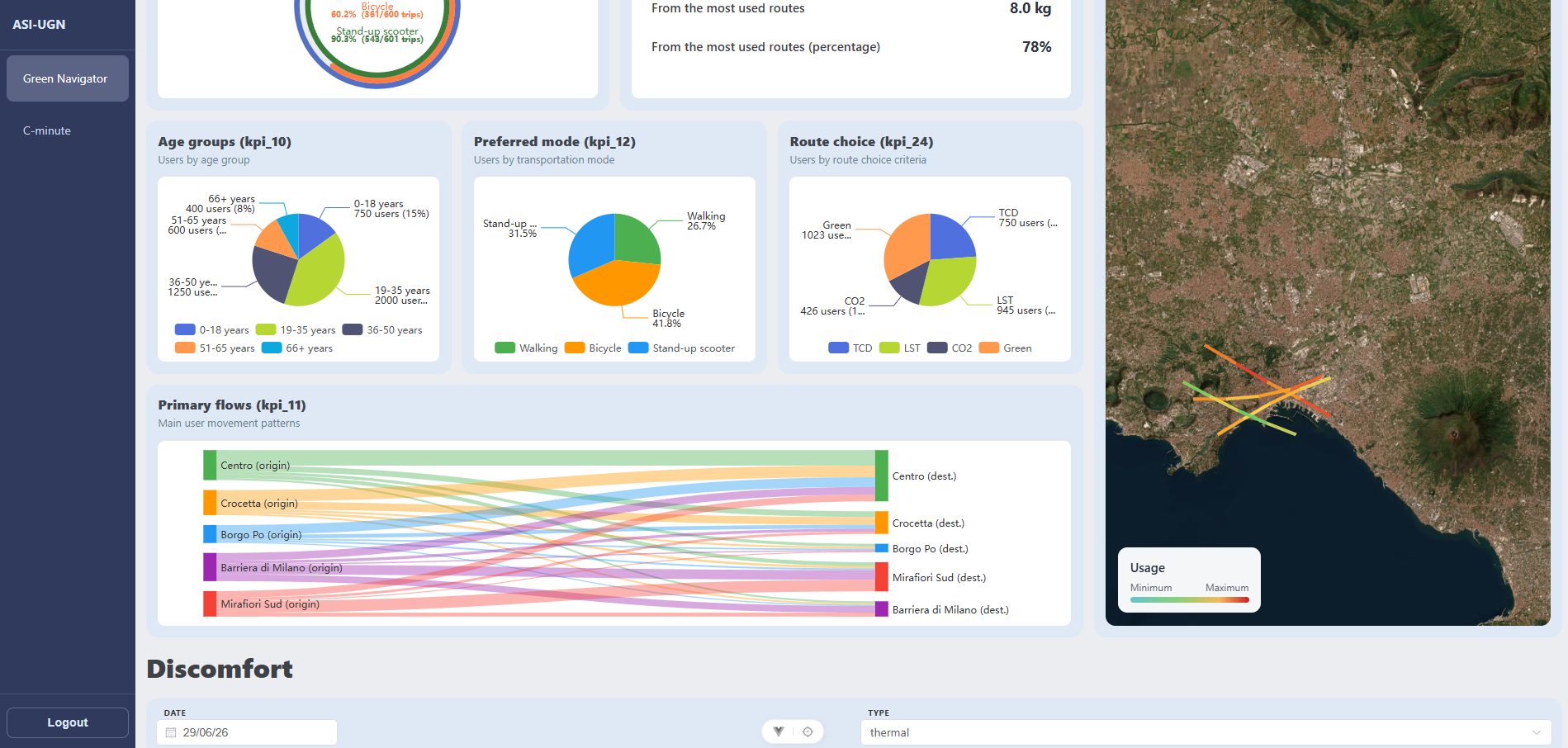
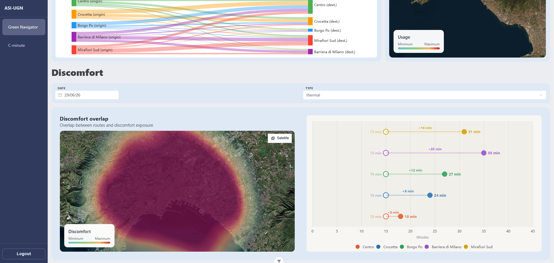
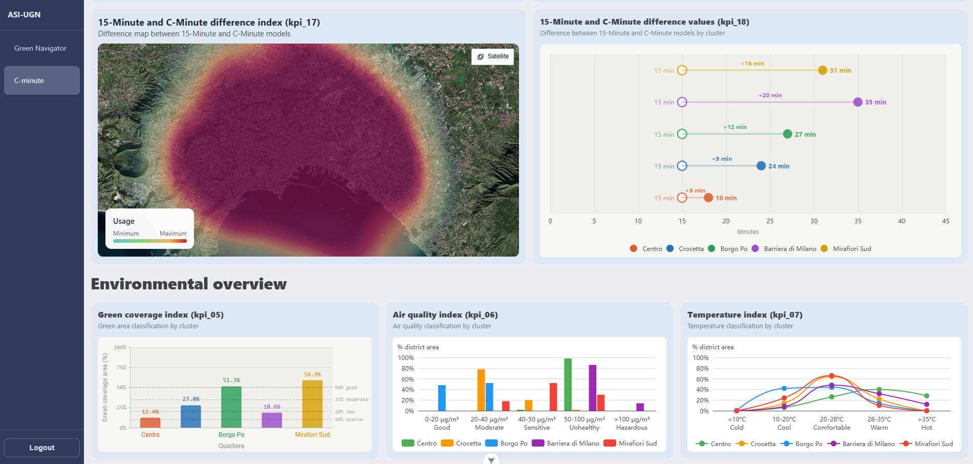
TeamDev’s Contribution. Within the project, TeamDev participates in work packages WP4000 and WP5000. In WP4101, “Development of the Soft Mobility Dashboard for Cities,” it integrates the Green Navigator and develops dashboards for exposure and mobility data, drawing on the experience gained with the WiseTown platform.
In WP5101, “Integration Testing and Pilot,” TeamDev is responsible for conducting functional and non-functional tests of the software components and for carrying out tests in the pilot cities, validating the consistency of the data with field measurements and collecting user feedback.
Why This Technology Matters
Satellite data with sub-10-meter resolution makes it possible, for the first time, to treat environmental comfort as a dynamic, continuously updated variable within routing algorithms—no longer just static or historical data. This makes it possible to move beyond the simple “shortest route” to the “most livable route”—a crucial distinction for those who travel on foot, by bicycle, or via micromobility, who are far more exposed to environmental conditions than those traveling by car.
The “c-minute city” paradigm thus marks an evolution beyond existing urban planning models: it does not merely measure accessibility to services but relates it to the quality of the travel experience.
The Benefits
For citizens, the benefit is immediate: those who travel on foot, by bicycle, or using micromobility options can choose routes that reduce exposure to excessive heat, pollution, and areas lacking green space, without sacrificing the efficiency of their journey.
For cities and mobility operators, the project provides a dynamic, georeferenced overview of environmental exposure at the neighborhood level, which is useful for guiding planning decisions—from the placement of public transit stops to the identification of areas where urban green spaces or heat mitigation measures should be implemented.
The dashboards can serve as a tool for city administrations to effectively plan public mobility. For example, the tool could be used to identify areas of the city where new public transit stops need to be implemented, to avoid pedestrian routes to services that pass through heat islands.
The c-minute city paradigm also offers a tool for objectively comparing the “temporal” and “comfort” accessibility of the same neighborhood, making it possible to measure an aspect of urban livability that has been difficult to communicate until now.
Finally, API integration with existing navigation systems and MaaS platforms allows the model to scale beyond the dedicated app, bringing environmental criteria into the tools already used daily by citizens and operators.