

In recent years, national and regional legislation has placed increasing emphasis on the issue of urban accessibility, requiring local governments to adopt concrete measures to identify, plan for, and remove architectural barriers. This is the context for the PEBA – the Plan for the Elimination of Architectural Barriers, an essential tool for ensuring equal mobility for all citizens, particularly people with disabilities, older adults, families with strollers, and anyone who may encounter obstacles when using public spaces.
What is a PEBA?
The PEBA is a technical-operational plan aimed at:
- mapping all architectural barriers present in public buildings and urban spaces
- analyzing their severity, impact, and priorities for intervention
- planning actions and investments for their removal
- monitoring the status of implementation over time
Many PEBA plans began as static documents: technical reports, CAD drawings, and lists of critical issues. Today, however, GIS technology allows these tools to evolve and adopt a modern, innovative, and transparent approach. PEBA plans can become dynamic, updatable, and shareable tools capable of integrating with other geographic data and supporting ongoing administrative decision-making.
Remarks by Chiara Ciarlini, Head of Public Works for the Municipality of San Venanzo, at GIS Day 2025
Why the Geographic Component Is Essential
The very nature of PEBA is inherently territorial: every barrier exists in a specific location, and addressing it makes sense only when contextualized within that space.
GIS therefore becomes essential because it allows us to:
- Pinpoint the location of each barrier with precision
Geographic location enables more accurate analyses of the distribution of critical issues and their actual impact. - Assess priorities and critical issues based on context
Not all barriers carry the same weight: near a school, a health center, or along a heavily trafficked route, a barrier may be far more significant. - Monitor interventions in the area
A dashboard can be generated showing what has been done, what is planned, and what remains to be done, thereby avoiding duplication or errors. - Integrate the PEBA with other municipal data
Urban planning, public works, mobility, road safety, land registry: GIS allows the PEBA to be linked to all these areas. - Sharing the PEBA with the public
An interactive map is an immediate, transparent, and effective tool for informing and engaging the community. - Easily updating the plan
Staff can quickly modify data and geometries, ensuring that the plan remains up-to-date and consistent at all times.
The Municipality of San Venanzo responded to requests from the Umbria Region to provide a structured PEBA geodatabase capable of integrating spatial data and alphanumeric information. The CAD system previously used did not allow for dynamic data management or effective use of the information, especially with regard to administrative transparency and monitoring of projects. The project was entrusted to TeamDev, which oversaw the complete migration of the PEBA to an ArcGIS environment.
The data was not only transferred but also reconstructed, normalized, and organized within a geodatabase compliant with regional standards, transforming the PEBA from a static document into an operational and strategic tool.
The GIS Application
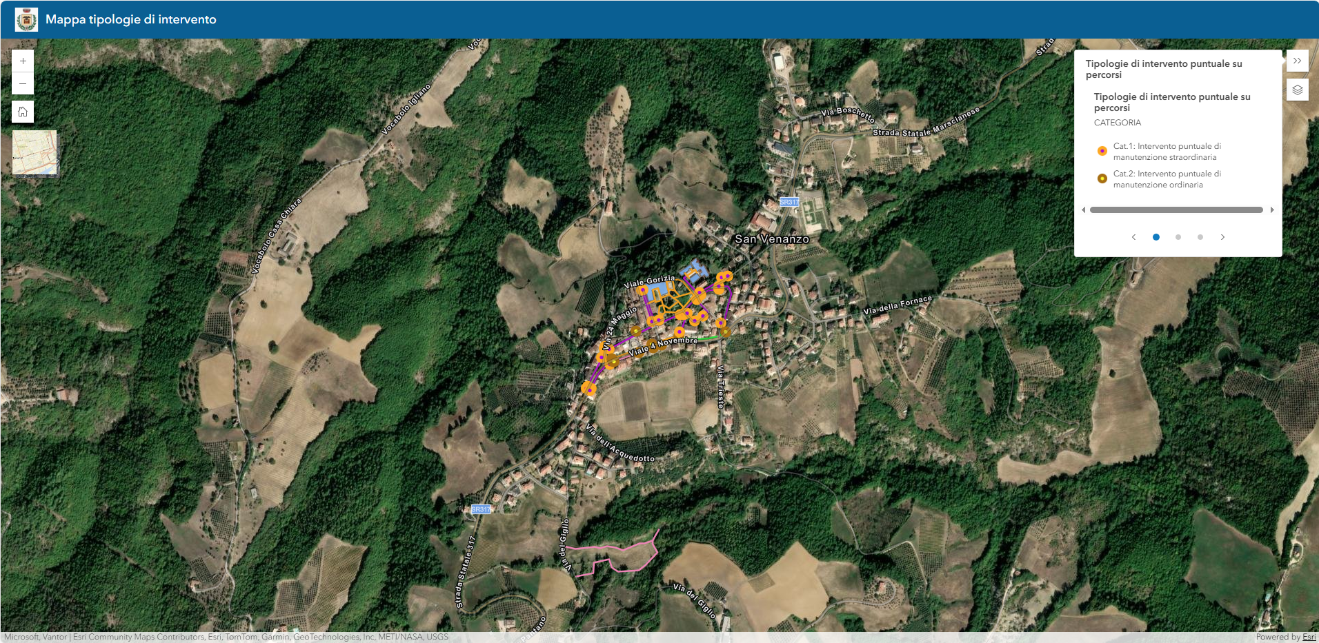
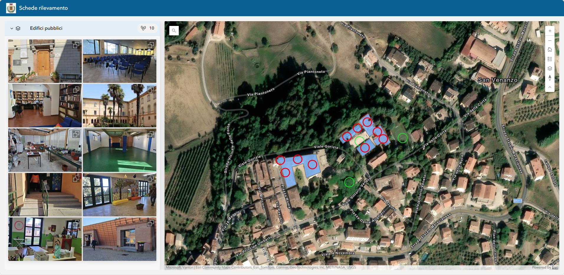
TeamDev has also developed a dedicated GIS application, with two levels of access:
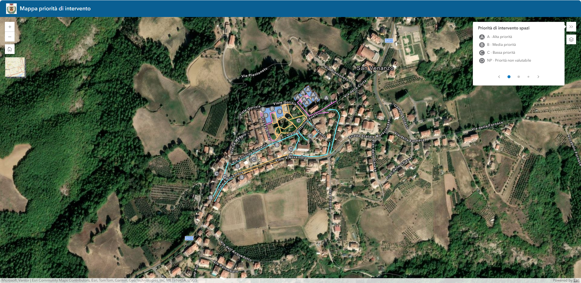
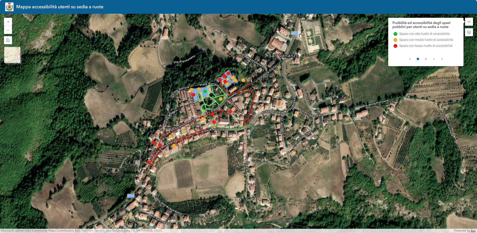
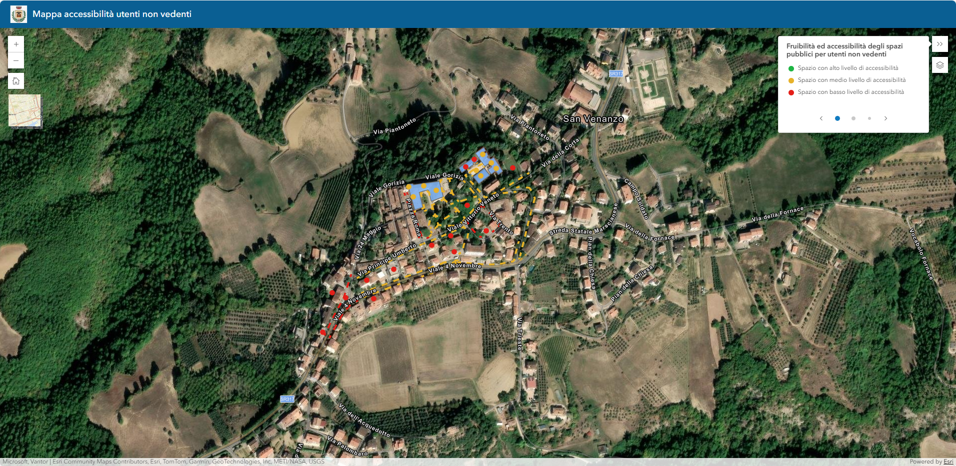
- Public: Viewing of PEBA maps, to support transparency and institutional communication.
- Municipal offices: Management and monitoring of projects, including oversight of financial planning, priorities, and progress.
The Benefits
Thanks to the adoption of GIS, the Municipality of San Venanzo now has a system that:
- Supports strategic planning
- Can be easily updated over time
- Can be integrated with other geographic data
- Is focused on transparency and cost control