

The energy transition requires a delicate balance between the need for new facilities and the protection of the landscape. To support the Province of Perugia in this challenge, we have developed a Decision Support System (DSS) application designed to objectively assess the impact of wind and solar power plants on the local area. As a technology partner, our goal was to transform complex analytical processes into an intuitive digital tool capable of guiding provincial technicians in the issuance of building permits.
Technology: ArcGIS Experience Builder and Advanced Geoprocessing
The application was developed by leveraging the power of ArcGIS Experience Builder within the ArcGIS Portal infrastructure. It is a secure, web-based platform that allows users to navigate complex geographic data through an intuitive interface.
The true heart of the innovation, however, lies in the custom features we’ve integrated: we’ve developed specific work widgets and advanced geoprocessing models. These tools don’t just display data—they process it in real time to meet the specific needs of the Province’s workflows.
Why This Technology Is Essential to the Project
Issuing a landscape assessment cannot be done without a comprehensive overview. The technology we have implemented allows us to instantly overlay the locations of the proposed new facilities with:
- All applicable land-use restrictions in GIS format.
- The locations of existing wind and solar power facilities.
- The digital elevation model (DEM) to calculate actual line-of-sight visibility and panoramic exposure.
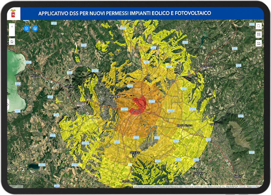
The use of customized geoprocessing models eliminates the need for subjective assessment: the system automatically intersects these layers of information, applying weighted coefficients to each restriction to generate a scientific analysis of the project’s compatibility.
The Benefits: Objectivity, Efficiency, and Documentation
The introduction of this DSS brings direct benefits to both office efficiency and administrative transparency:
- Documented objectivity: The outcome of the assessment is no longer subject to varying interpretations but is based on a weighted calculation of all the territorial factors taken into account.
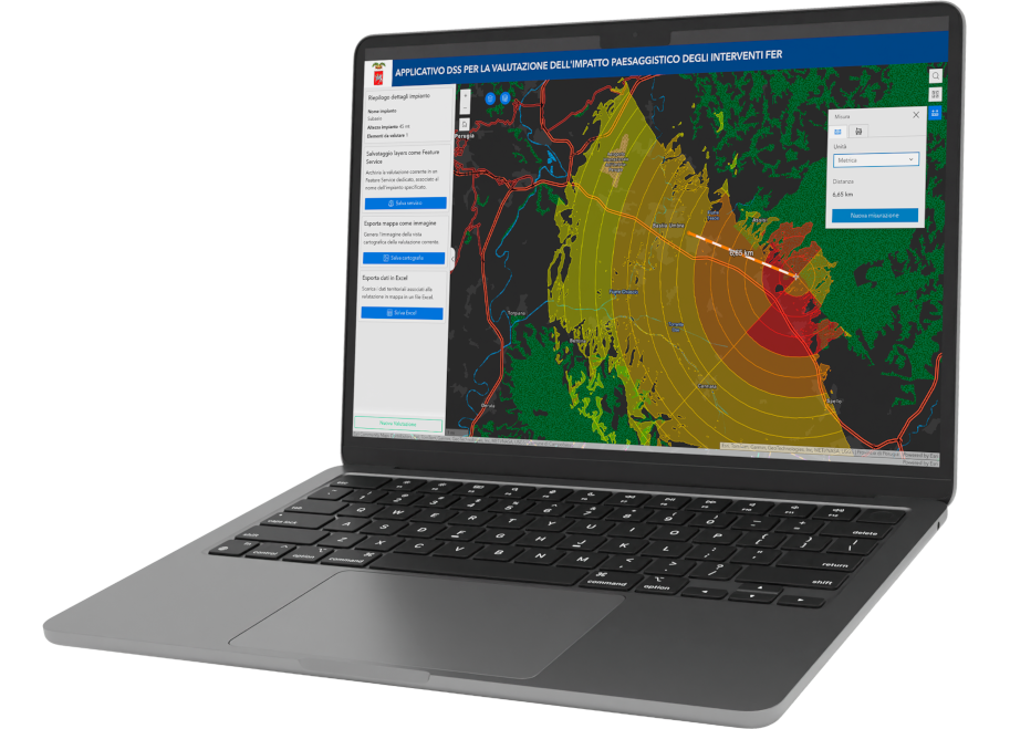
- Instant choropleth maps: The system automatically generates maps indicating the degree of eligibility for the new project, making it immediately clear where critical issues lie.
- Exportable outputs: The operator can download scoring tables and detailed maps, which become an integral and documented part of the bureaucratic file.
- Time Optimization: The system’s ability to automatically cross-reference dozens of datasets drastically reduces the time required to study the area, allowing technicians to focus on the final validation of the assessment.
With this tool, the Province of Perugia is equipping itself with cutting-edge technology to manage the growth of renewable energy while fully respecting the identity of its territory.
From the Field to Research: The Project Paper
If you’d like to learn more, download the scientific paper presented by Mauro Magrini at the Esri Italia 2026 Conference.
Magrini is the head of the Department of Territorial Planning, Environment, Information Systems, and Communication for the Province of Perugia and has been working for years to evolve the province’s GIS infrastructure toward models of territorial governance based on data objectivity.