

A Partnership Between Research and Geospatial Technology
Understanding ecosystem dynamics and protecting biodiversity today requires a shift in perspective: it is no longer enough to observe the territory from a single point of view; rather, we must combine the scientific rigor of field research with the analytical power of geospatial technologies.
It is on this basis that an important research project funded by the European Union under the NextGenerationEU program has been launched, bringing together the University of Palermo, TeamDev Ecosystem, and the company In-Time in a synergistic collaboration.
The initiative focuses on the Iblea Area, a landscape mosaic of extraordinary natural value in southeastern Sicily, with the goal of conducting an integrated assessment of its flora and vegetation diversity and environmental heterogeneity. Within this broad and complex context, TeamDev oversaw the design of models and workflows to process satellite imagery and calculate environmental indices, supporting its partners with specialized activities involving the provision, analysis, and integration of remote-sensing data with field surveys conducted directly on the ground.
The Remote Sensing Analysis System and the Geographic Dimension
At the heart of the project is a geospatial analysis system based on data from the European Copernicus Sentinel-2 satellites. Going beyond simple static land mapping, satellite technology makes it possible to quantitatively and dynamically describe both the landscape structure and the ecophysiological conditions of the vegetation.
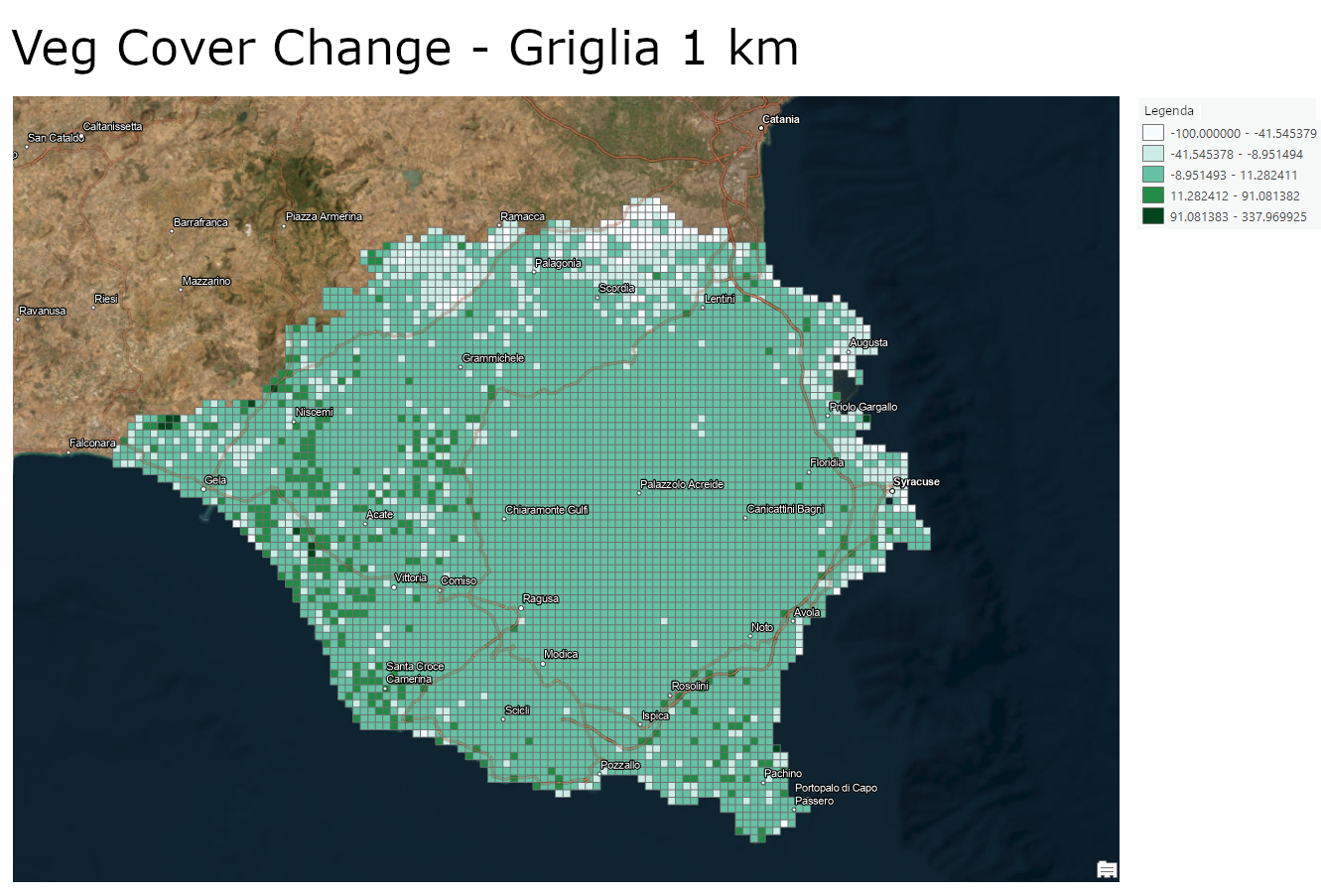
The workflow developed by TeamDev begins with meticulous preprocessing of satellite data—essential for ensuring the consistency and reliability of the analyses— and continues with multi-temporal monitoring spanning an 8-year period, from 2017 to 2024, capable of capturing seasonal variations and the evolution of vegetation cover over time.
In this context, the use of GIS (Geographic Information System) and the geographic dimension proves crucial: it allows for linking the biophysical parameters observed from space with the actual environmental characteristics of the territory, integrating metrics of fragmentation and ecological connectivity with land-use categories, field botanical surveys, and regional climate models.
Technical Analysis Infrastructure and Monitored Indices
To transform satellite pixels into precise assessments of the environment’s health, the technical infrastructure developed by TeamDev calculates and integrates various indicators useful for studying the territory and its evolution over time:
- Indices for studying vegetation, such as NDVI, NDBI, and NDMI.
- Indices related to land use and land cover.
- Other indices useful for understanding landscape diversity and fragmentation, such as the Shannon diversity index, Contagion Index, and Splitting Index.
These indices were then correlated with datasets from the Global Human Settlement Layer program, developed by the European Commission’s Joint Research Center, relating to built-up areas and resident population.
Finally, the multitemporal value of small woody features was calculated to analyze ground cover by small vegetation elements.
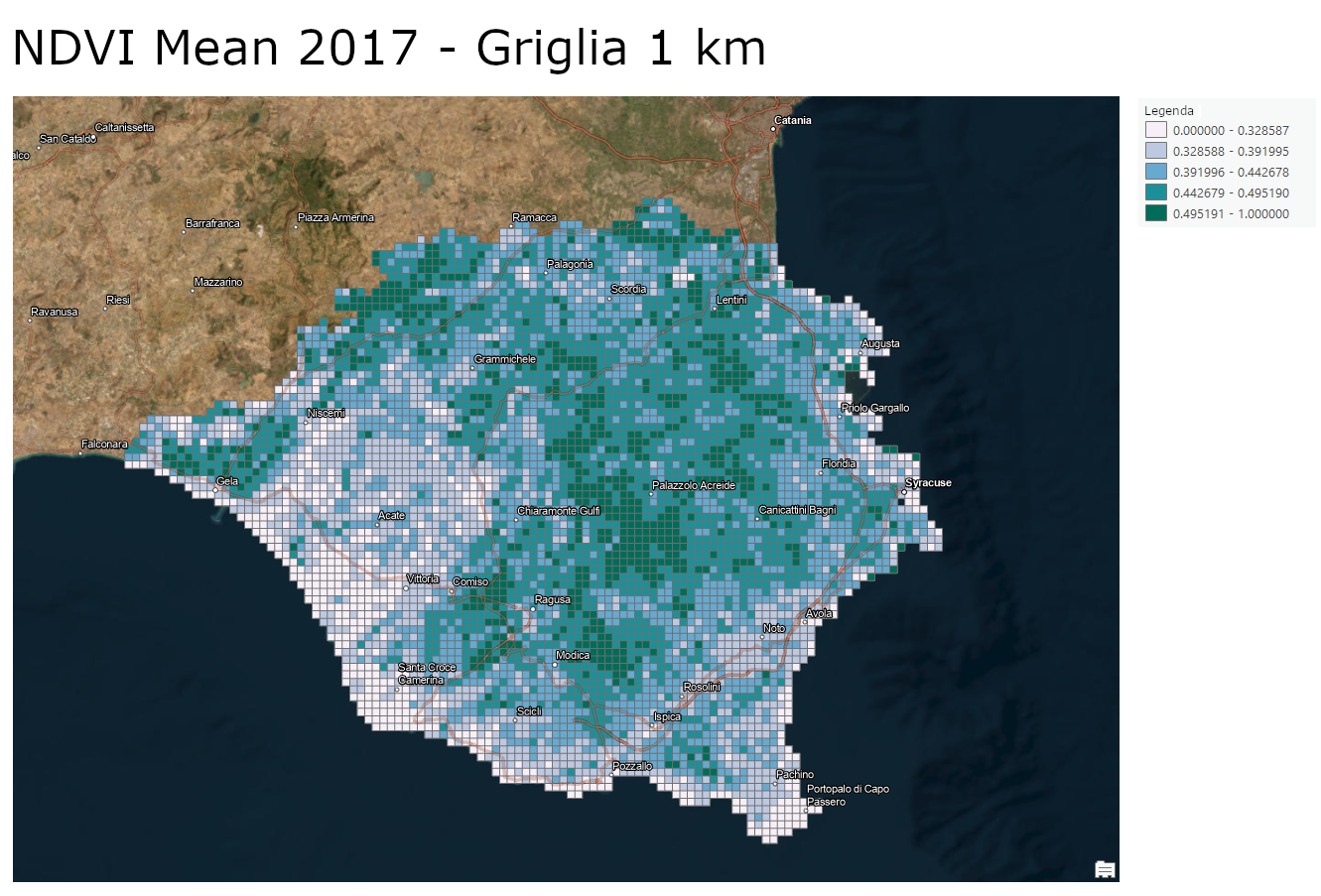
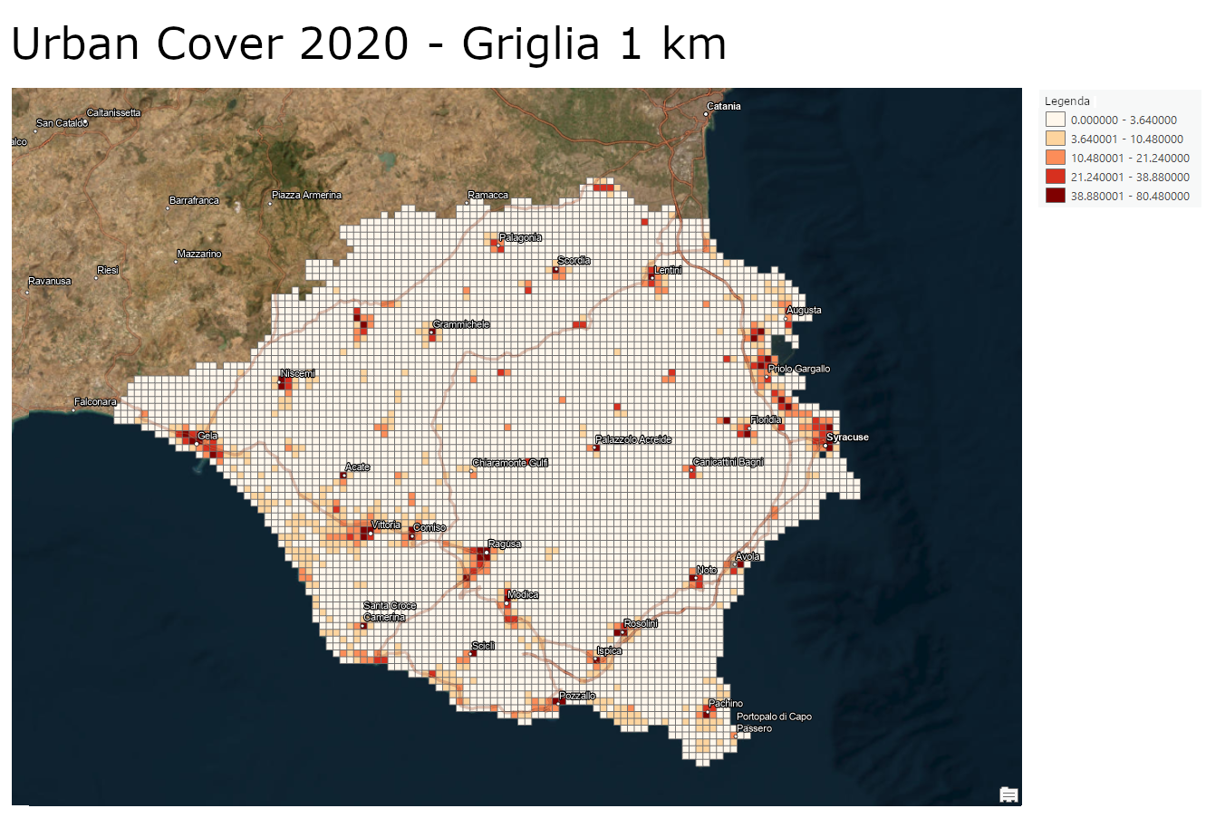
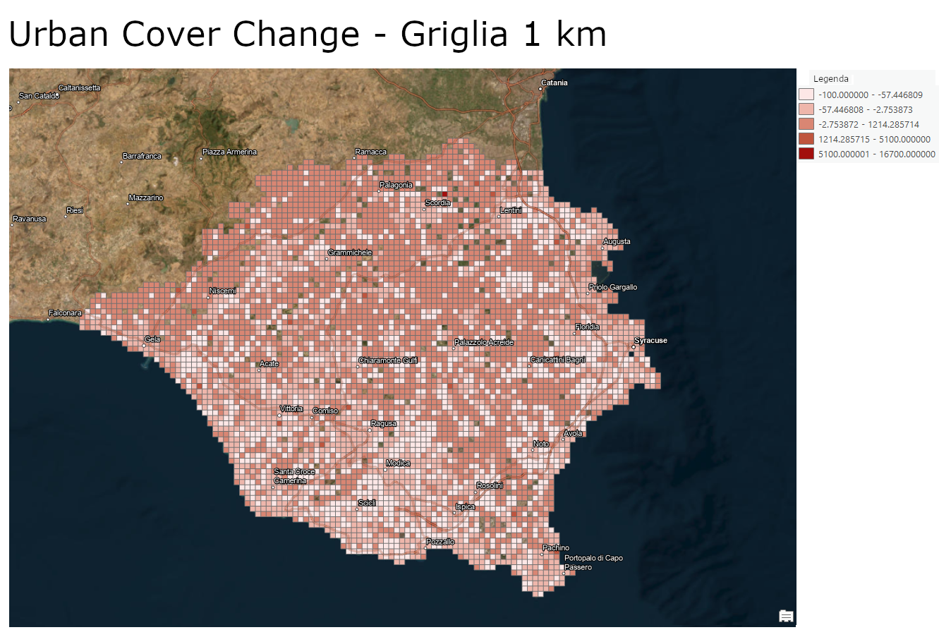
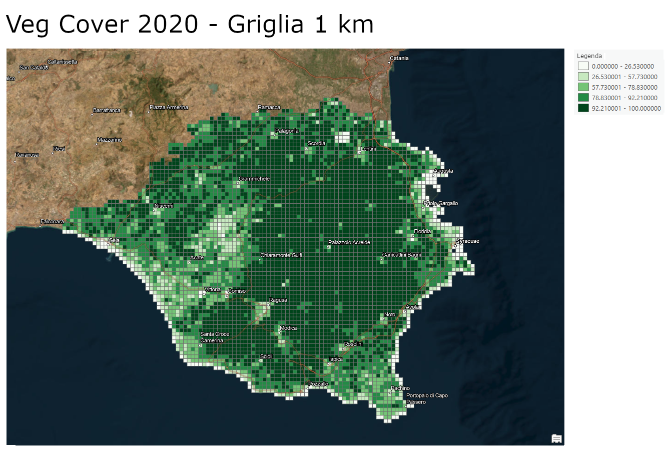
Data Generation and GIS Output
Upon completion of the project, TeamDev produced and provided the partnership with an integrated package of geospatial deliverables:
- Thematic cartographic products: high-resolution maps of landscape structure and ecological indices.
- Standard geospatial datasets: ready-to-use geographic layers that are fully compatible with leading GIS environments, such as QGIS and Google Earth Engine, as well as other analytical platforms.
- Integrated technical-scientific report: an in-depth analysis document that correlates satellite indicators with land-use units, the Nature Map, and field surveys.
The Benefits of the Project
TeamDev’s integrated approach transforms complex data into concrete decisions, generating value on multiple levels:
- For scientific and ecological research: it provides quantitative, objective, and spatially explicit indicators to monitor the evolution of ecosystems.
- For land management and public administration: it supports environmental assessments and land-use planning processes with reliable data that can be replicated over time.
- For climate monitoring: it enables the analysis of cross-cutting relationships between vegetation cover, soil conditions, and thermo-hydrological parameters.
- For biodiversity conservation: it ensures a deep understanding of ecological dynamics in a context of exceptionally high natural value, such as the Iblea Area.